In nature, a river divides the borders between two countries; hence, a map is drawn of two banks for the geography to appear before history. On the other hand, colonization charts military borders for history to reappear before geography. Exhibiting history before geography supposes a realistic proposition. Contrary to such objectified geography is a proposition based on nature, to form a universal imagination, as if reality is war and nature is fiction.
The Arabic word بعد (Boa’d) carries many meanings; it is the space that distances us from a certain point and the longing for it. Second, it is the dimensions that measure shapes and our remoteness from them. It also refers to a vision that is at once an insight to judge and to investigate future realizations. This series of artworks, titled Boa’d, describes varying nuances of what distances us from our homeland and measures what is left from territories and their identity. Boa’d narrates a genealogy of the historical map of Palestine up until today. The art of crafting maps critiques the political image of maps and gives voice to human suffering. It not only shows a dark vision of a map of Palestine moving toward disappearance but also arouses the audience and engages them with an imminent sight of what remains and what is missing from the map of Palestine. This artwork presents a detailed intimate insight into the meaning of a non-functional map, in order to predict the future of the land.
Today, the shape of the West Bank looks like a kidney, as it becomes the new map of Palestine and the holy triangle has disappeared within occupation. A mixed-media artwork of metal wires and colourful silk threads weaves the maps of the West Bank and Gaza strip on the canvas. There we see the Green Line separating historical Palestine, the West Bank, and Israel, like a wary face looking at the besieged Gaza Strip, missing the beach and Galilee. The silk threads spread across the canvas, weaving Palestinian cities, roads and military checkpoints, a spider’s web destroying our homeland.
Notes: Some of the findings from my research include:
The length for the metal wires and the silk threads that create this artwork is equal to the length of the historical border of Palestine.
The length of the separation wall is double the length of the Green Line.
The distance between the West Bank and the Gaza Strip is equal to the distance from the north to the south of Gaza.
There are more roads around Palestinian cities than there are roads that lead to these cities.
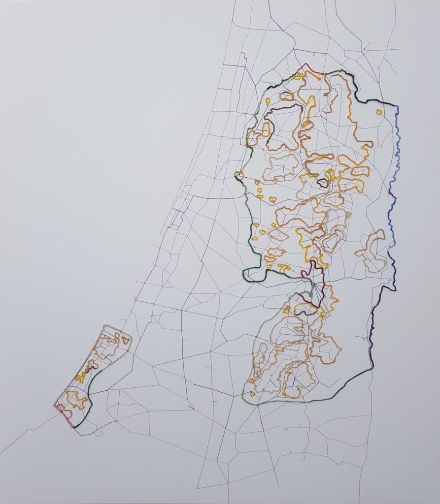
Metal wires and silk on canvas, 120x120cm
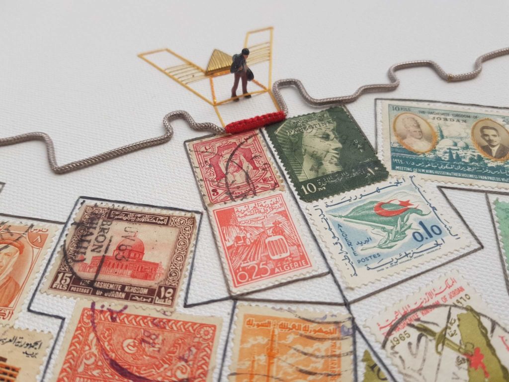
Jerusalem, 2018, Detail, Metal wire, silk threads and stamps on canvas, 90x120cm
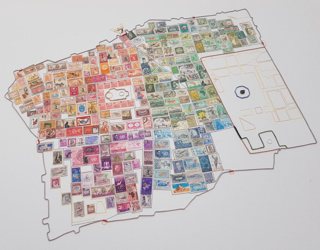
Jerusalem, 2018, Metal wire, silk threads and stamps on canvas, 90x120cm
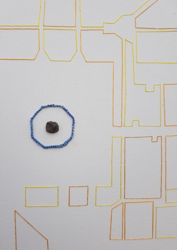
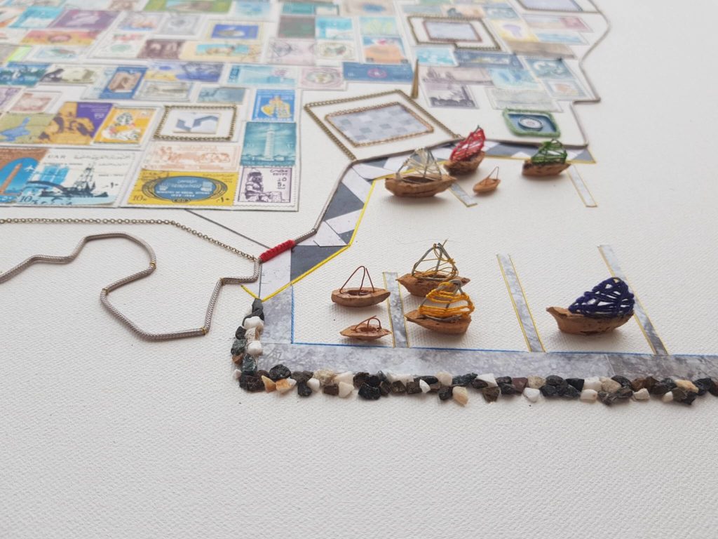
Jerusalem, Detail, 2018, Metal wire, silk threads and stamps on canvas, 90x120cm
Mapping of the Old City of Jerusalem made from postage stamps from the Arab World in the early 1960s. A light silver wire draws the walls of the Old City, silk threads weave the gates and the roads, the garden of Al Aqsa Mosque, the Dome of Rock, the Church of the Holy Sepulchre, the Western Wall, the Armenian Museum and Damascus Gate. The postage stamps show the character of the Old City and refer to the identity. Here Jerusalem is not recognised as the capital of Israel, but as the capital of Palestine, and the essence of the Arab World since forever.
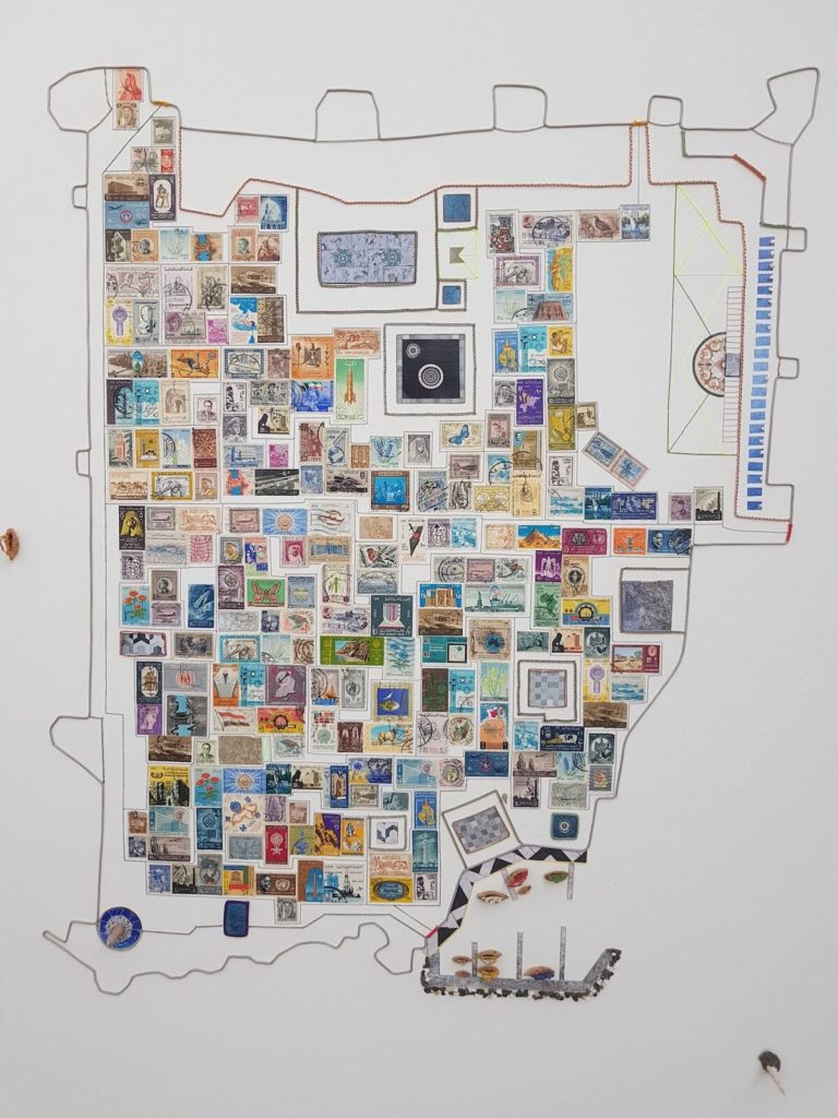
Metal wires and stamps on canvas, 120x90cm
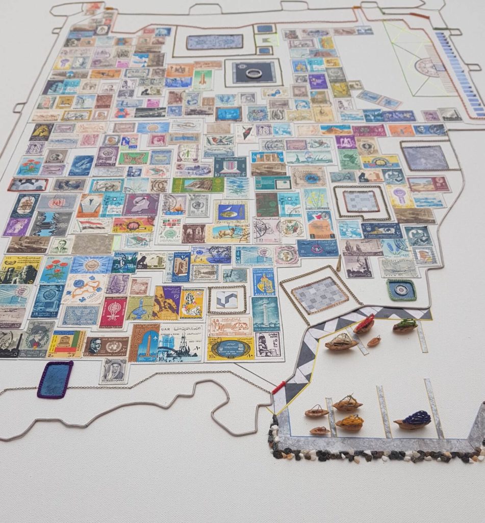
Metal wires and stamps on canvas, 120x90cm
